

Hawkes Preserve – Gorham, 41 acres

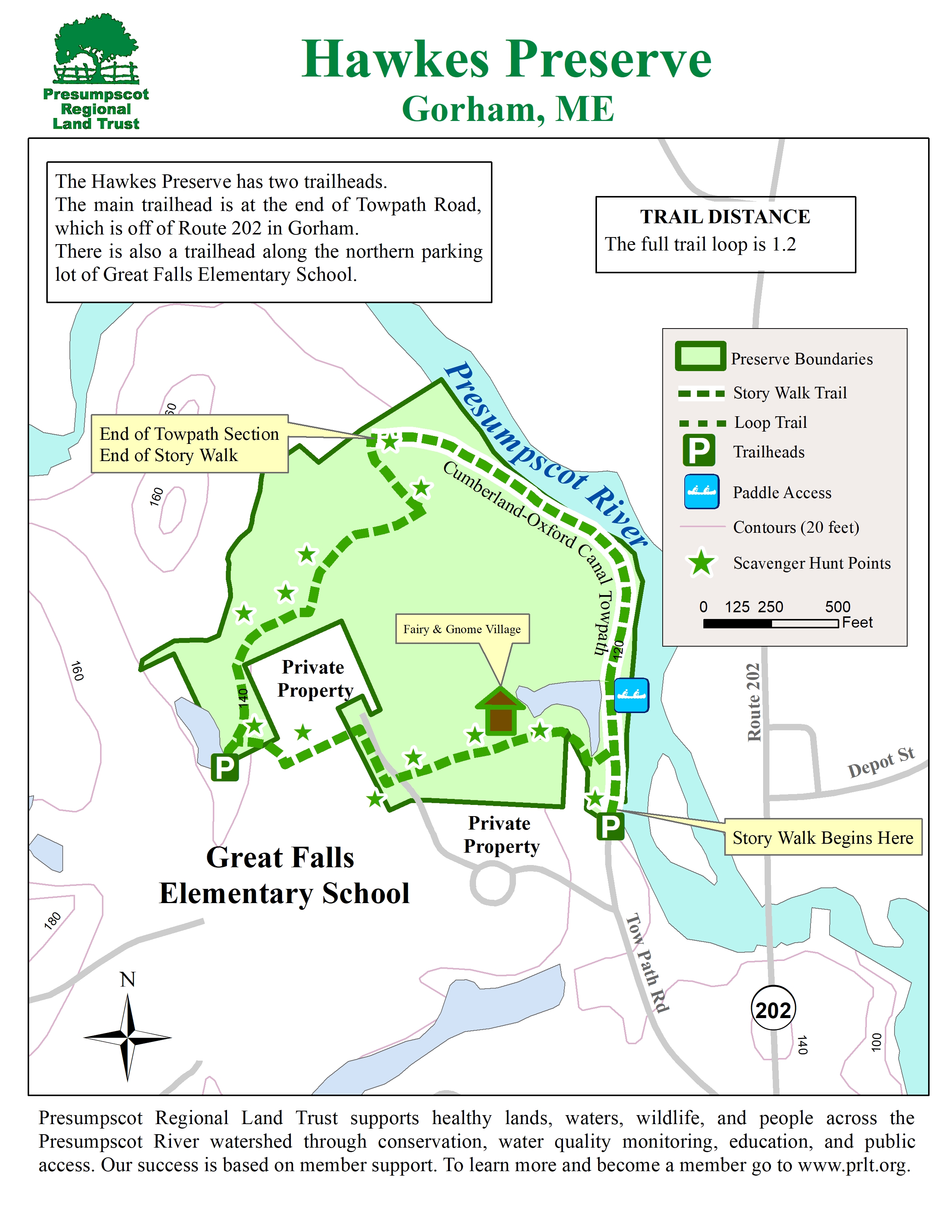
There is a 1-mile nature loop trail on the Hawkes Preserve, which includes several stops to learn more about the natural area. The trail winds through hemlock forests, along the scenic Presumpscot River and includes the historic Cumberland and Oxford Canal. This is a cool and shady summer hike.
This Preserve is in the homeland of the Wabanaki People. We respectfully acknowledge these People of the Dawn–past, present and future–and their connection to these lands and waters.
Please see below for the trail map and more information about the preserve and trails.
TRAIL FACTS
Activities: hiking, running, snowshoeing, cross-country skiing
No Hunting
Leave No Trace: Please take out whatever you bring in.
Difficulty: Easy
Length: 1 mile
Click for Directions to Trailhead
Trail Map (click to expand)
About the hawkes Preserve
Come walk the one mile nature loop trail, which includes nearly 2,000 feet of trail along a beautiful stretch of the Presumpscot River and see the remains of the historic Cumberland and Oxford Canal. The Hawkes Preserve is adjacent to the Great Falls Elementary School and the trail can be accessed from the school or Tow Path Road.
Tow Path Trailhead: At the end of Tow Path Road off Route 202 in Gorham.
Great Falls School Trailhead: 73 Justice Way, Gorham. Park at the back of the school lot. The trail begins at the bottom of the hill by the school’s outdoor classroom.
There is no hunting allowed on the Hawkes Preserve and motorized vehicles are not allowed (excluding snowmobiles).
Hawkes Preserve is owned in fee by the Presumpscot Regional Land Trust.